
The "King Peak" in the depths of the Gangdise Mountains—pho la bya khyung Kangri

King Peak is located between Saga County and Dengpa County in the Xizang Autonomous Region, belonging to the Gangdise Mountains. The Tibetan name for King Peak is pho la bya khyung Kangri, with an altitude of about 6530 meters. Due to its almost perfect pyramid shape, it looks like an equilateral triangle when viewed from a specific angle. The slopes on both sides are symmetrically spread out at a 45 degree angle, and from a distance, it looks like a spear piercing the sky. This unique geometric shape makes it stand out among many snowy mountains and is praised as the "King Peak". The King Peak is located between Saga County and Dengpa County.(China Tibet Online | Zhao Zhenyu)

The Tibetan name for King Peak is pho la bya khyung Kangri, with an elevation of approximately 6530 meters. (Drone shooting) (China Tibet Online | Zhao Zhenyu)
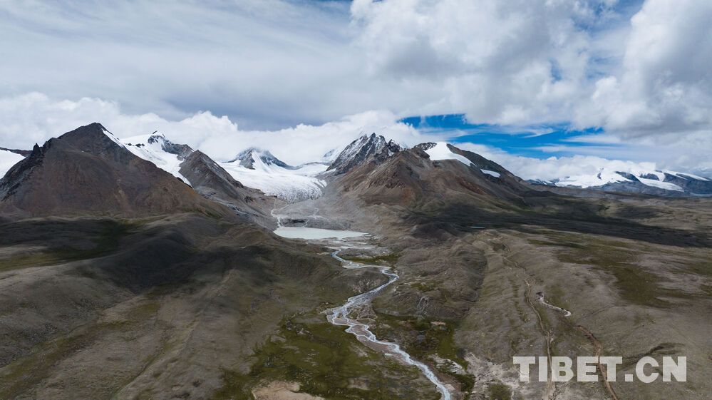
In the Gangdise Mountains, gangs rin po che is often mistaken for the main peak. But the real main peak i sblon po gangs ri, located on the side of pho la bya khyung Kangri at an altitude of 7095 meters. Due to the majestic and majestic shape of Mount pho la bya khyung Kangri , in local legends, the higher altitude sblon po gangs ri is known as the "Minister Snow Mountain", while pho la bya khyung Kangri is revered as the "King", and the two are regarded as brothers guarding the sacred mountain.(China Tibet Online | Zhao Zhenyu)
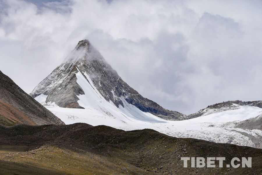
The King Peak Mountain has a perfect triangular pyramid shape, with a straight and sharp mountain posture, like a spear piercing into the sky, which has a strong visual impact. (China Tibet Online | Zhao Zhenyu)